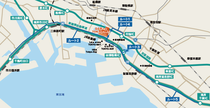
By car
Access route map
-
From Tokyo
-
Route 1
Keiyo Road → Hanawa Interchange → National Route 14 (Go back 1km)
-
Route 2
Expressway Bayshore Route → Chidorimachi Interchange → National Route 357 (6.5km ahead)
-
Route 3
Expressway Bayshore Route → Yatsufunabashi Interchange → National Route 357 (Turn back at the first traffic light and go back 2.5km)
-
-
From Chiba
-
Route 4
Keiyo Road → Hanawa Interchange → National Route 14 (1km ahead)
-
Route 5
Higashi-Kanto Expressway → Wangan Chiba Interchange → National Route 357 (6km ahead)
-
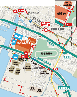
Suburban map
-
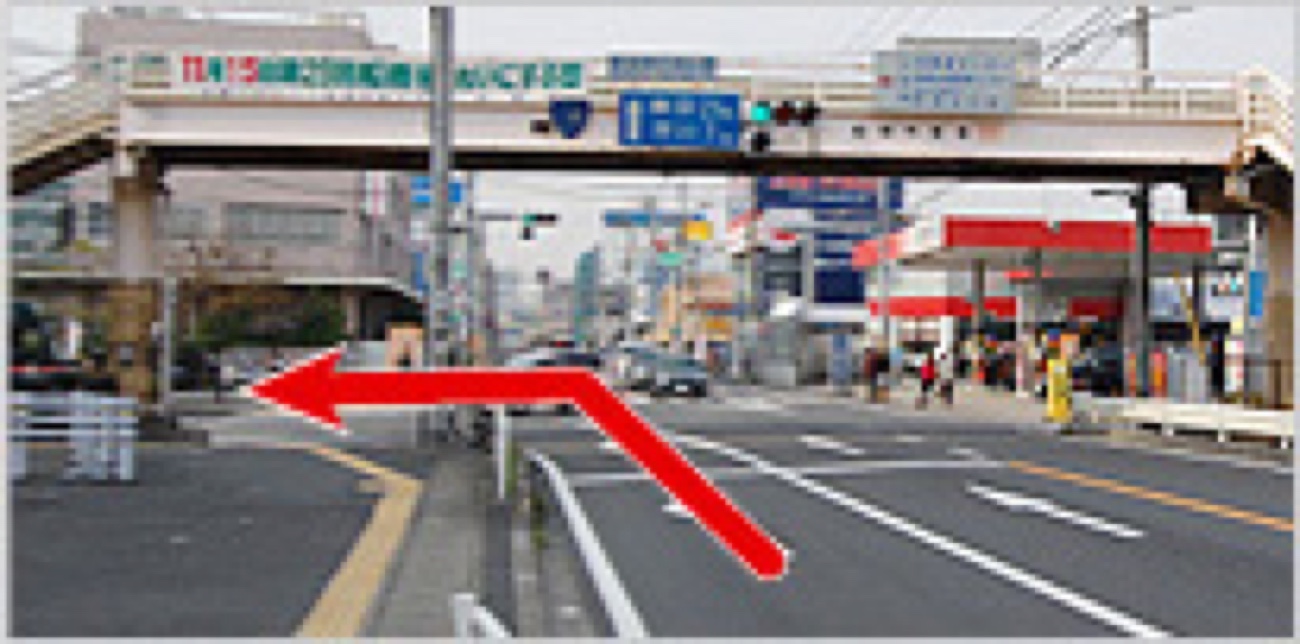
Point A
If you are coming from Ichikawa on National Route 14, turn right at the Funabashibashi traffic light.
-
Point B
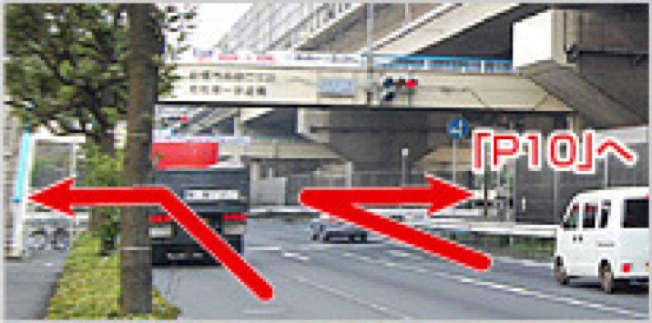
If you are coming from Chiba on National Route 14, turn left at the "Funabashi City Miyamoto" pedestrian bridge.
-
Point C
If you are coming from Tokyo on National Route 357, turn left at the "Hamacho 2-chome" traffic light.
*When it is crowded on holidays or other occasions, you can enter the parking lot relatively smoothly by turning right and using "P10".